Right now, I am staring at the conference poster printer in confusion of what to write; I cannot say that I am asked to participate in features regularly. I am in what I believe to be the study room, fluorescent lights shining dimly above me as my fingers glide across the keys of my laptop. My Snapple kiwi-strawberry drink lays empty from frequent consumption, the blue cap on the table from a refusal to spread the beverage over a long time. Sometimes, setting up these little moments help get the brain pumping and aid in obtaining ideas on how to best portray what you need to say. I aim to introduce you, the reader, to a project I have been working on and what I hope to obtain from this experience.
The project I am working on is the development of a climate asset map with the Midwest Climate Collaborative. Focusing on 12 states, the Collaborative aims to help the entire Midwest region and bring to attention the issues uniquely faced as a region and on a state basis. According to the Collaborative, the project aims to help external and internal audiences easily access, contribute to, and use the information around climate action in the Midwest. I am working on updating a database for potential survey participants along with a survey draft. This will be sent out to individuals to see what they want to be included in the asset map. We currently have around 250 individuals to reach out to on the database, with the ability to add more as we go along. The survey is still in its draft phase, but the target audience, type of questions, and format have been worked on extensively. The final draft should hopefully be finished sometime this week and be ready to send out to potential survey recipients. This will be much later down the road, in February, but the Climate Collaborative will hold a climate summit. At this, the Collaborative will present the findings from the survey that is being constructed and propose the beginnings of the asset map that is being worked on.
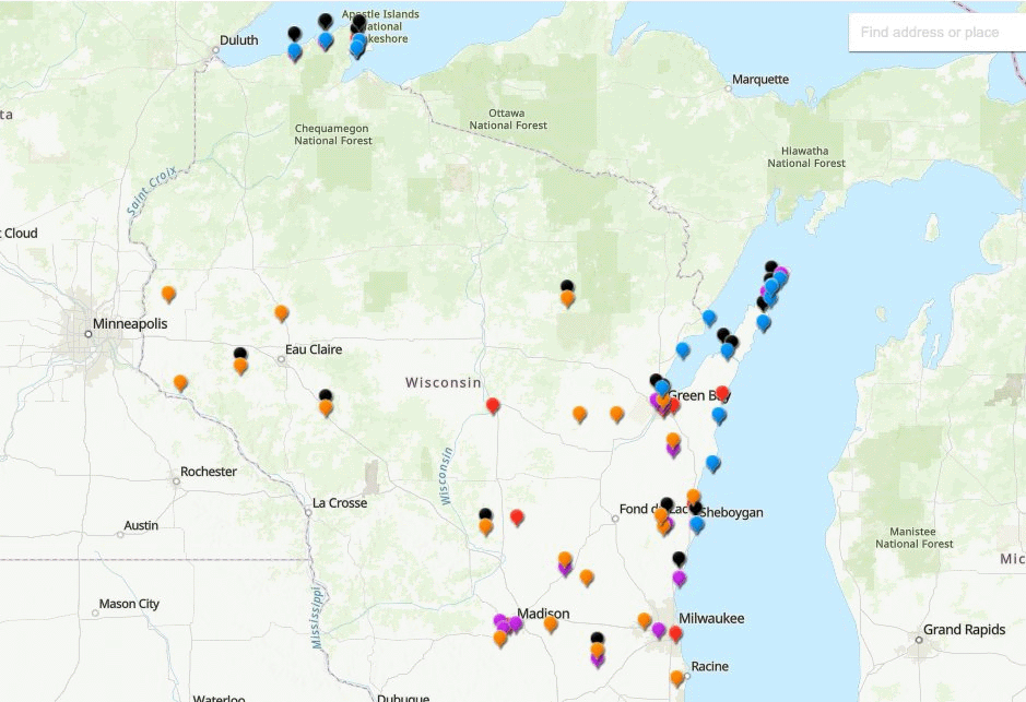
This is a map that I made for the Wisconsin Sea Grant’s Eat Wisconsin Fish program, which shows the location of fish producers, distributors, and resources.
I secured this position through past work with Meghan, where I worked on an outdoor recreation and tourism project focused on how these sectors would be impacted by climate change. Through the skills learned from this and my general interest in the topic, Meghan reached out to me to see if I wanted to work on this project. At the time, I thought that I would not be able to do it, since I had an additional job. However, I found a way to make it work by reducing hours in the other position, so I could obtain experience in a more relevant career and educational setting. I also have relevant experience working with the Wisconsin Sea Grant in 2021, where I worked on a producer map for Eat Wisconsin Fish. This map aimed to display producers, vendors, and educational resources of sustainable fish in Wisconsin. I was able to use skills obtained from that internship in the current asset map position. Based on both the project’s similarities and experiences along the way, I can work with the Midwest Climate Collaborative on this fantastic opportunity.
I believe that the main goal of my undertaking this opportunity was for relevant experience in graduate school and my future career. I am planning on becoming a professor in the future, and from what I have learned, it is of utmost importance to have as much relevant experience as possible. Academia is an incredibly competitive field; every little bit of experience matters. Once I get into graduate school, I plan on pursuing a PhD in geography. I plan to focus on arctic communities, their historical and geographic differences, and how these factors impact future sustainable development.
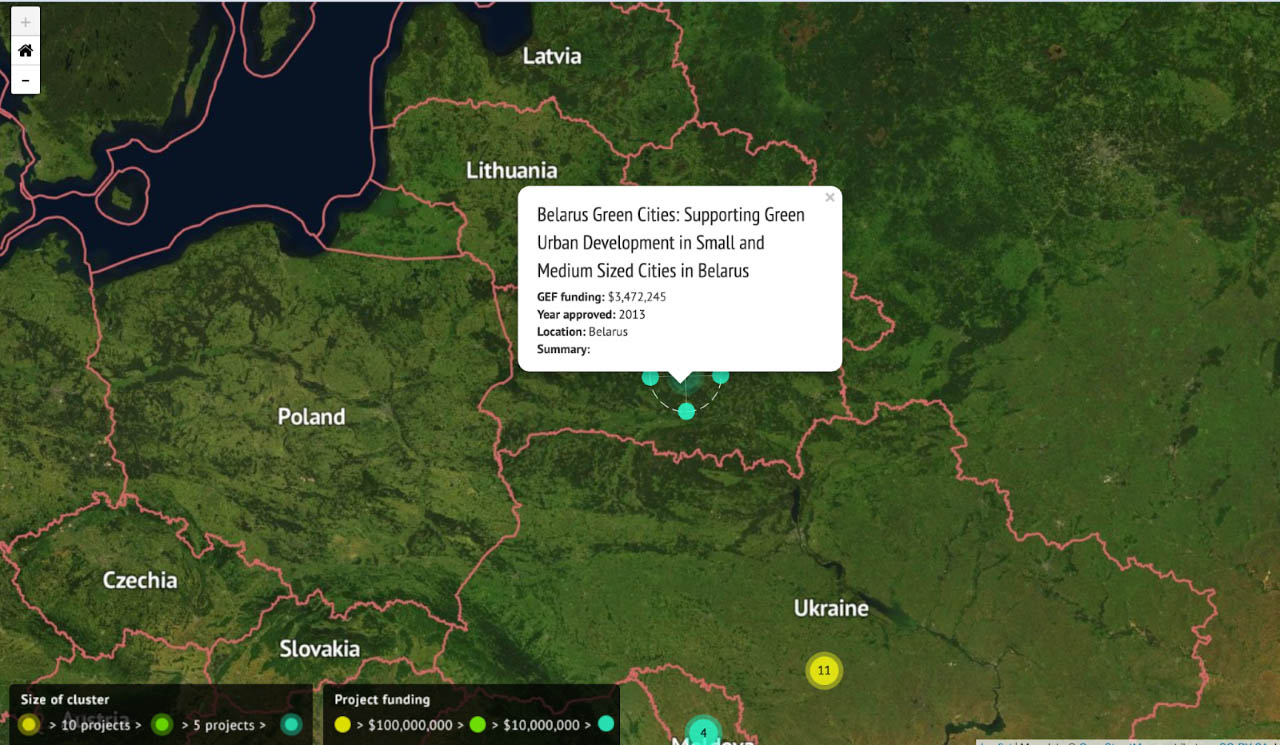
The image above shows an example of an asset map with an international perspective. The name of this asset map is from CarbonBrief, and the main focus of the organization is environmental policy.
This project is funded in part by the Midwest Big Data Innovation Hub.
 Rowan Goldman ’23 is a senior in the

